Liberia's waters face overfishing from foreign fleets, harming local ecosystems and fishers despite government profits. This project explores how limiting trawling could impact fish stocks and income, helping policymakers balance ecological and economic needs.
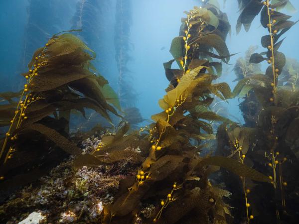
This project enhances marine conservation by standardizing habitat analysis within California’s Marine Protected Areas (MPAs) using spatial data and remote sensing. By creating detailed habitat maps and statistical comparisons, it provides crucial insights for researchers and policymakers evaluating the effectiveness of the MPA network.
Clients: Channel Islands National Marine Sanctuary, Santa Barbara County Air Pollution Control District, NOAA National Centers for Coastal Ocean Science, NOAA - National Oceanic and Atmospheric Administration